London has the Lambeth Walk, just one neighbourhood, but Austria goes many times better and crosses the whole country in 33 stages of the Eagle Walk. It’s also a bit up and down with a total height gain of 31,000m and you’re in the mountains, so the right gear is essential.
It’s well signposted with yellow signposts and red and white trail markers painted on trees and rocks along the route. At the start and end of each stage, information stations with maps detail the difficulty level, walking times and places to get food and drink. Even better, there are benches liberally scattered along the trail, where you can rest your weary legs.
I’m going to be walking the first three stages through the Wilder Kaiser or Wild Emperor Mountains in North Tyrol. They’re aptly named as they rise up to over 2,300m in lofty jagged rock formations, their slopes covered by forest and tumbling mountain streams and waterfalls. The start point is just outside St. Johann in Tirol and I’ll finish in Kufstein, the 2nd largest city in Tyrol after Innsbruck.
Stage 1: Rummelhof – Gaudeamushütte 13 km, 5h
It’s a bright and sunny morning as a taxi takes me the short distance from St Johann to the start of the walk at the Rummlerhof, a traditional tavern. The trail first takes the road uphill then cuts up through the trees, climbing steadily upwards, mercifully in the shade. A section with safety chains leads to Diebsöfen where large caves eat into the rock face and the traverse is slightly tricky.
An easy climb takes me to the once mighty Schleierwasserfall, now reduced to a trickle where I walk under the waterfall and rock face. I’m soon in alpine meadows and on a forest road leading to Obere Regalm hut where there’s food and drink. I don’t stop, but climb up onto a saddle with a mountaineer’s grave.
This is today’s highest point, over 1500m, with tremendous views to reward my climb. It’s then an easy descent to the Gaudeamushütte hut, at an elevation of 1,263m, my base for the night. The sun sets in the mountains around me as I eat a hearty alpine meal.
Stage 2: Gaudeamushütte – Lake Hintersteinersee 14.5 km, 6h
Everything starts at sunrise in mountain huts, so after breakfast, I’m soon climbing. I’ve been warned that ahead of me is a stretch with ladders and cables, only for those with a head for heights. Wondering if I’ll be up for the job, I ask an elderly couple who are going my way, and they assure me I’ll be OK. Fortunately, it’s dry, and I manage the tricky bits without a problem.
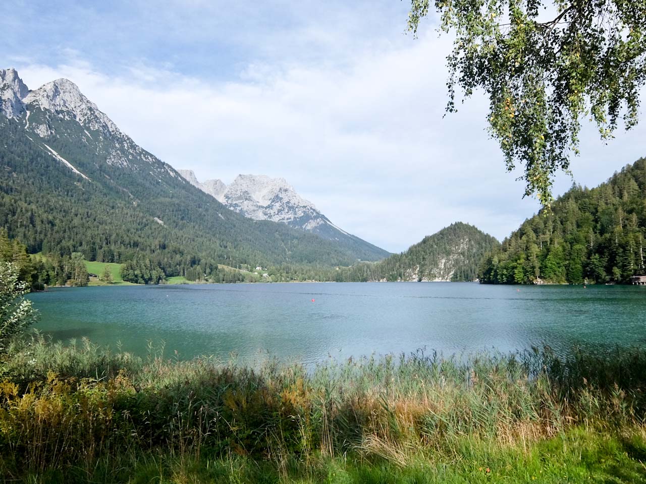
There’s a final steep stretch to the Gruttenhutte, and then it’s a gentle downhill on a dirt road. The trail veers upwards on a path through the forest, all tree routes and stones, taking me to the next refreshment chalet at Steiner Hochalm. Now here, instead of going down to the lake, I mistakenly follow the Eagle Way signs which take me up and down for over an hour to another set of huts at Walleralm. The sign says it’s another hour to Hintersteinersee and I resentfully trudge downhill. Still, I’m rewarded with a pleasant stay at Pension Maier with a view of the beautiful lake from my balcony.
Stage 3: Lake Hintersteinersee – Kufstein: 9.5 km 3.5h
It rains overnight, and it’s drizzling when I set off, retracing my steps back up to Walleralm on the forest road. It begins to get brighter, and I’m soon climbing steeply up to the Hochegg ridge at 1470m. Mercifully the cloud has lifted, and I get magnificent views of the Inn Valley and the Zahmer Kaiser Mountains. It’s all downhill from here, and I pass Steinbergalm and Kaindlhütte huts before taking a forest trail.
There’s another bit of uphill to the Brentenjochalm hut and nearby there’s a chairlift which could take me all the way down the mountain. Although storm clouds loom, I continue on foot and reach Kufstein just before the rain. After the calm of the mountains, this bustling metropolis of less than 20,000 people comes as a bit of a shock. It’s dominated by the mighty 800 year old castle which is also home to the largest open air organ in the world. Later I’m privileged to hear a recital from the comfort of my hotel room.
The Eagle Walk is a popular route and there’s also a welcome sense of camaradie among the hikers. I’ve been impressed in the last few days by the quality of the signage, yellow signposts everywhere and easy to follow red and white flashes leading the way. Even better there are plenty of refreshment stops with mountain huts offering good filling Tyrolean fare and excellent local beer and wine. I hope to come back and tackle the next stages.
FACTBOX
INFO: Hiking in the Wilder Kaiser Region has information about walking.
The Eagle Walk has information about the first 3 stages in the Wilder Kaiser Region.
Kufsteinerland tourist board has information about the city.
Tirol Tourist board has information about the region.
GO: EasyJet flies direct from Gatwick to Innsbruck with return flights from £68.
Four Seasons Travel can arrange transfers.
STAY: Hotel Post in St. Johann in Tirol makes a comfortable base at the start and has good food.
Gaudeamushütte nestles in the mountains and serves typical Tyrolean fare.
Pension Maier at Hintersteinersee has a beautiful view of the lake and has great food.
Arte Hotel is right in the centre of Kufstein by the castle.
EAT: Restaurant Purlepaus in Kufstein serves good local cuisine
[the_ad_placement id=”manual-placement”]


